Isle Royale Journal - Spring, 2013
This journal details a trip to Isle Royale National Park, in the Spring of 2013, through words, pictures and videos.
This is a preliminary outline of what I hope to be a full movie one day featuring videos, pictures and narration of the trip. This was truly a unique trip and, most likely, a once in a lifetime experience on the island due to the conditions.
Some Notes on the Journal
- If you click on any of the pictures, a larger version will load in a new window. All of the pictures were taken by us except where noted. The pictures are from various sources as we had two still cameras and three video cameras, so they will vary in size and resolution. They have also been made made smaller for faster display on the web.
- The satellite images of the days on the island were captured when we returned and are from the archives at: www.ssec.wisc.edu.
- If you click on any of the videos, the video should play with your default video player. All videos are at 854 x 480 resolution. These are only quick edits and are not perfect. Also, I did not do anything to the sound yet so, there will be more noise (especially wind) than a finished video would have.
- All times are Eastern Daylight Time.
- I record the weather conditions during the trip. When on the island, this is one of the important things in your day as you settle into the "wilderness state of mind". Ever since I have started bringing a barometer, I have found it to be a useful tool in predicting the weather. The temperature gives you some idea of the conditions during the trip and the time of year. All the temperature and barometer readings are based on my watch, a Suunto "Vector". My watch records the barometer over the past 6 hours and records in two sections. The first one is for the last 3-6 hours and the second the last 0-3 hours. When recorded, these are shown in this document as "steady", "rising" or "falling". Of course, when on my wrist, the temperature is inaccurate and I do not record it. Also, while moving, the barometer changes due to changes in elevation. So I wait until both "settle out" before recording them.
Top
This was to be my 20th trip to the island and my 6th time taking the first boat of the season out of Grand Portage, Minnesota. This was Nancy’s 6th trip to the island and her 3rd time taking the first boat. We booked our tickets to take us from there and drop us off at Malone Bay where we were planning on doing the itinerary to the right.
Even before leaving, we knew this was going to be an interesting trip. The entire island was still in a deep freeze, with all of the inland lakes frozen, and Washington Harbor frozen solid all the way to the North Gap.
On April 17th, I talked to Ranger Greg in Houghton when I was ordering our season passes and he reported that there had been 2 heavy snow falls in the last week and they were expecting another heavy snow over the next couple of days. The Ranger III was scheduled to make its first run to the island on the April 18th and
they cancelled the trip. A run was re-scheduled to Windigo on the 28th and he said it might be in jeopardy unless the coast guard did something.
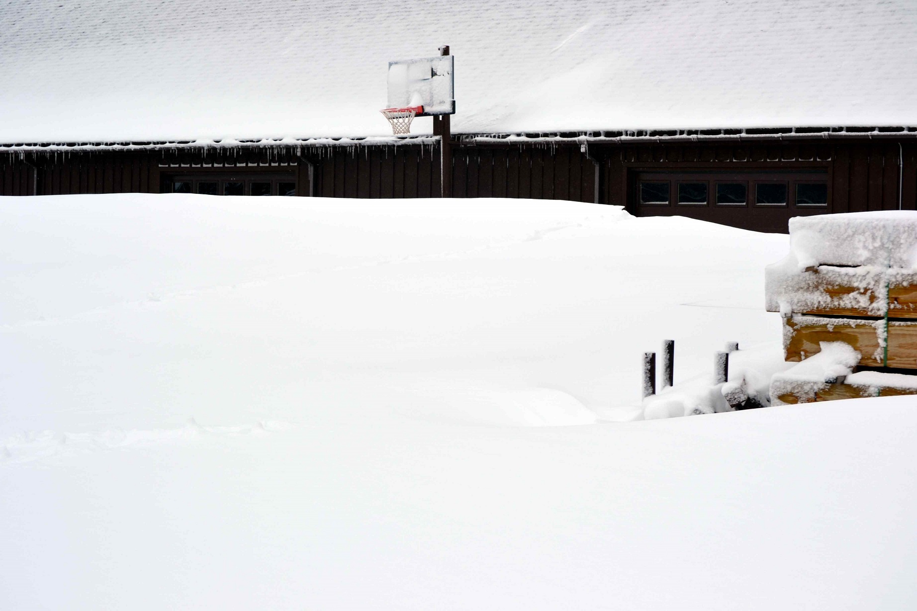
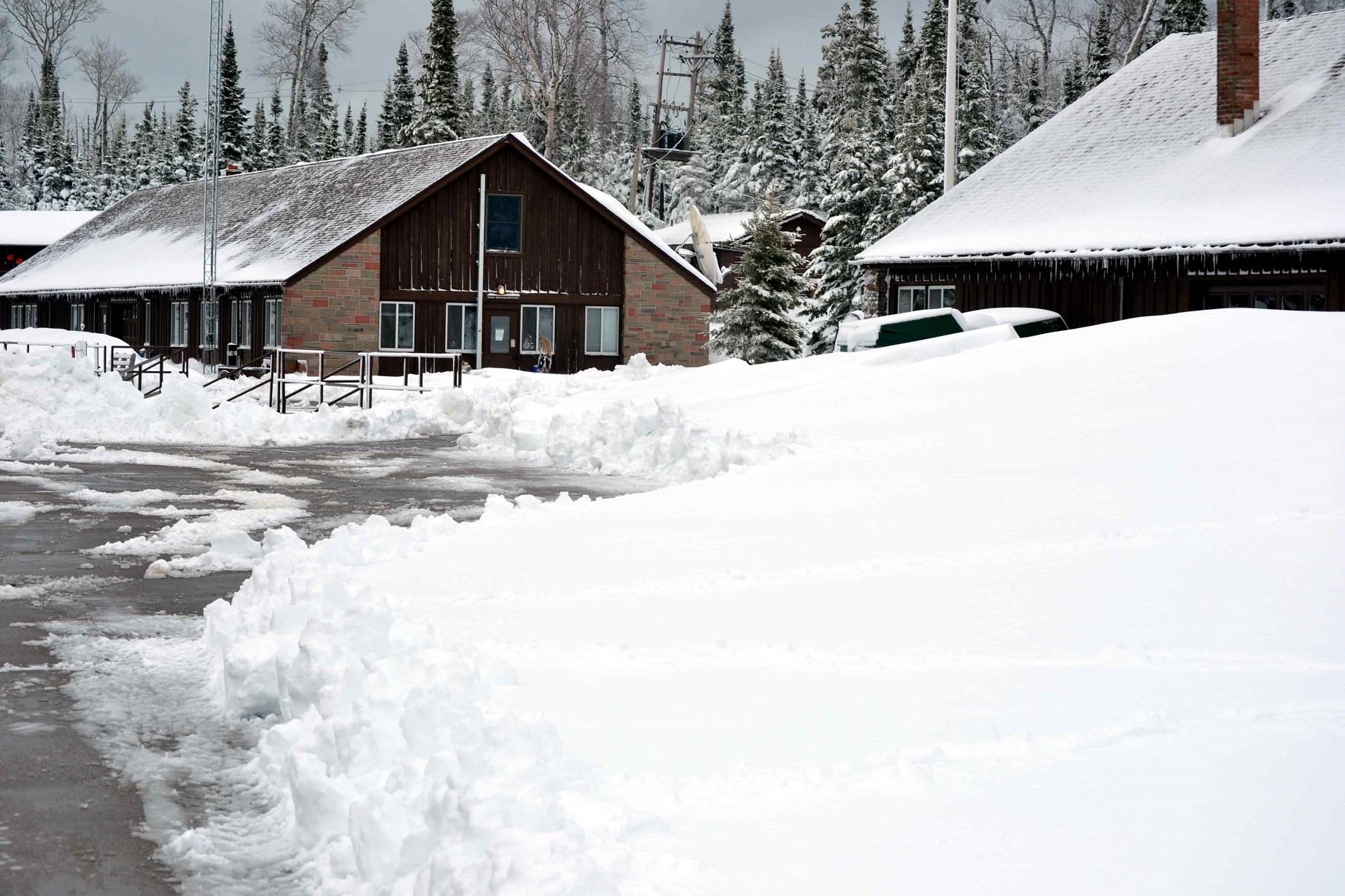
Below are pictures of Mott Island posted by Ranger Greg on the parks Facebook page. They were taken April 22.

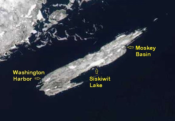
It was later posted on the Isle Royale Forums page (www.isleroyaleforums.com) that The Ranger III had tried to go into Windigo, but they could not get in and could only see the dock. It became part of our daily ritual to pull up NOAA MODIS daily satellite photos to see how much of the ice had melted. This is what we saw:
satellite april 24th (with labels).
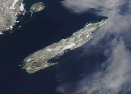
satellite april 30th.
As you can see in the satellite imagery, the inland lakes were completely frozen and Washington Harbor and Moskey Basin were mostly frozen. Based on the imagery it did not look like the boat would even be able to get to the Daisy Farm dock.
Then, this was posted on the parks website and Facebook page on May 1st:
"The National Park Service advises that campers and visitors to Isle Royale National Park should be prepared for winter camping conditions on the island for the next few weeks. Most docks are ice bound, and shore access is limited due to slowly melting ice shelves ringing the archipelago. Park Superintendent Phyllis Green says that visitors should monitor satellite photos for up-to-date information on access to bays and harbors. Even snowshoe travel is compromised and strenuous. “Our primary concern is that visitors understand what they are facing if they visit the island in early May. These conditions naturally limit emergency response, so visitors need to be prepared for a true wilderness experience with a focus on self-reliance and safety. There is no potable water at entry points or campgrounds, and no gas or diesel sales are currently open for motorboats. We will monitor marine band radio, but remember there is little to no cell phone coverage on or around the island".
Thursday, May 2nd - Home to Marquette, Michigan
We left our home in Port Sanilac, Michigan, along the shore of Lake Huron, where it was 80 degrees and sunny. I was wearing shorts and a t-shirt and was baking in the sun all the way up to the UP. Arriving in Marquette, it was a little chillier, but still in the low 70’s. We overnighted in Marquette as it is about halfway to Grand Portage and about 8 hours of travel time. We checked into our hotel and got settled in before going out to dinner. We returned and had a couple of beers while sitting outside in front of our room before going to bed.
Friday, May 3rd – Marquette to Grand Portage, Minnesota
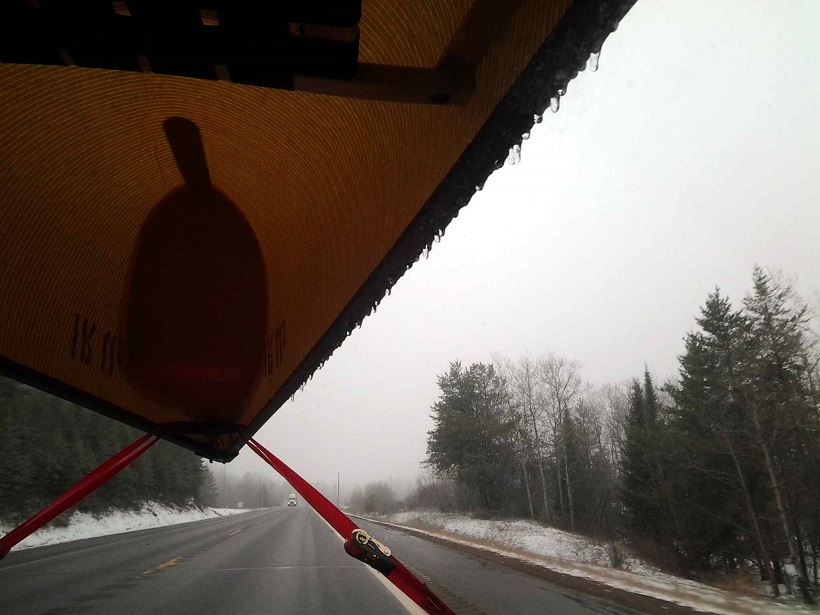
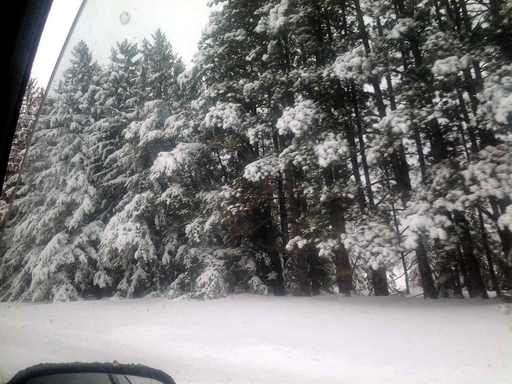
We woke up the next morning to find that we had had freezing rain during the night. The car and canoe were completely ice covered. It was still sprinkling as we loaded up the car and hit the road again. Heading west, the sprinkles continued off and on until changing over to snow. By the time we reached Bruce Crossing it was a regular blizzard and the ground was completely covered.
just after leaving marquette.
Near Bruce Crossing.
Just past Bruce Crossing, we received a phone call from Captain Don who told us, based on conditions; the park service was only letting him go to Rock Harbor and Daisy Farm at this time. He was not even sure he could get into Daisy Farm because there might be ice pack at the dock. He said we could cancel the trip and that everyone else had canceled except for the Wolf/Moose study team who were supposed to go to Daisy Farm. We told him we were more than halfway there and that we were going. There really was not any thought of cancelling, this was going to be a trip of a lifetime.
The snow continued to fall and as we drove across the Upper Peninsula, and as we got further west, we saw that the ground had a lot of snow on it already. There was 8” of snow in Iron Mountain, and reaching Ashland, Wisconsin, there was a good 12” of snow, but the snow stopped falling at least and the drive became easier. As we continued west, the snow on the ground began to disappear until we reached Superior, Wisconsin, where there was no snow on the ground. We had called Richard Kaufman (Fonixmunkee) and we were going to meet him for lunch in town. We met him at Gronk’s Grill & Bar in Superior and enjoyed a nice lunch with some great beer and conversation before heading back on the road for the drive along the north shore towards Grand Portage. As we were heading north, it began to snow again, but it was a wet snow and not a problem driving. Just before passing through Grand Marais the ground began to be white again from a previous snow fall, and by the time we reached Grand Portage, it was a solid white snow cover around 6 to 8” deep.
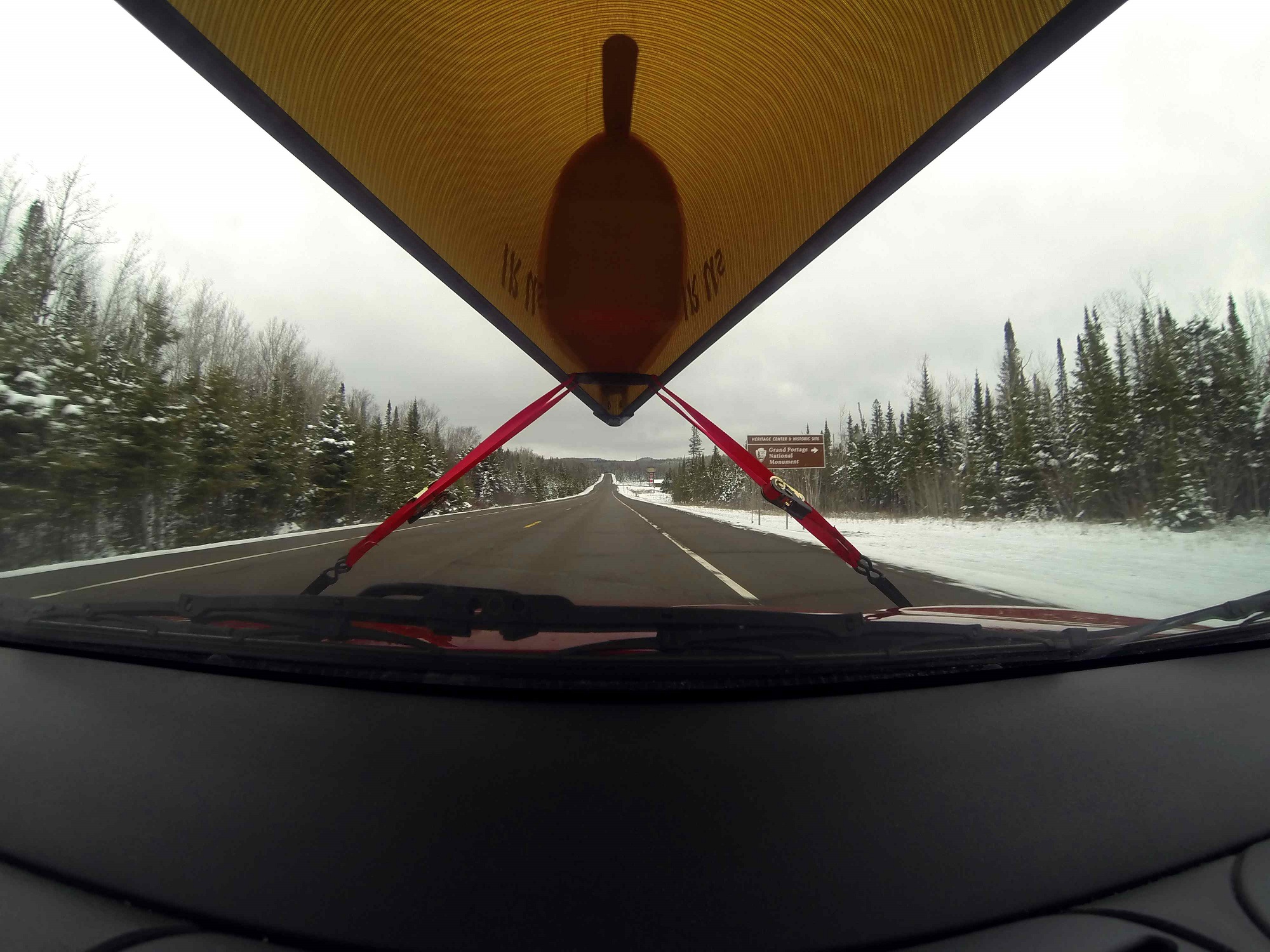
our canoe with the grand portage monument sign on the road.
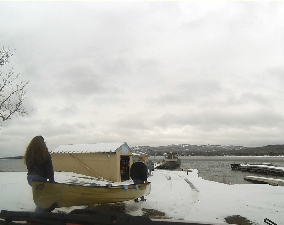
dropping off out canoe at the voyaguer dock.
We drove straight to the marina and dropped off the canoe, then went into the office and talked to Don and Paula for at least a half an hour before heading to the lodge and getting our rooms.
We ate dinner at the restaurant then went to the lounge where we sat with Don and Kurt for a couple of hours talking and enjoying a few “pops” before heading up to the room for the night. In talking to Don, he probably would have cancelled the trip if it were not for the study team going out.
Plus, there was a lone kayaker at Rock Harbor that had paddled all the way from Grand Portage to the island the week before and he was desperate to get off. Apparently he was on the north side of the island and had a real hard time finding places to land and had to land on ice shelves and slide across on the ice.